


THE MAPS tells their own tale. A row is brewing about what they say.
Clearly council planners are worried that future development might be held back by such a large Neighbourhood Planning area
Castlefield residents have banded together hoping to create a Neighbourhood Planning area. These were created by the Localism Act 2011 to give residents and businesses more clout over planning matters that directly affect them. The deadline for making your views felt is 18 April and you can do it here.
Neighbourhood Planning areas are pithily, well almost, summed up by the Royal Town Planning Institute (RTPI) thus:
'Neighbourhood planning is a right for communities introduced through the Localism Act 2011. Communities can shape development in their areas through the production of Neighbourhood Development Plans, Neighbourhood Development Orders and Community Right to Build Orders.
'Neighbourhood Development Plans become part of the Local Plan and the policies contained within them are then used in the determination of planning applications. Neighbourhood Development Orders and Community Right to Build Orders allow communities to grant planning permission either in full or in outline for the types of development they want to see in their areas.
'It must be stressed that the policies produced cannot block development that is already part of the Local Plan. What they can do is shape where that development will go and what it will look like.'
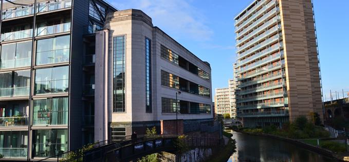 Is the area up the Bridgewater Canal really Castlefield?
For more from RTPI about the scheme click here.
The initiative seems to make sense especially in a residential area of a city centre which is bubbling over with redevelopment plans and thus threatened with a potential loss of charm, amenity and individuality. It would give residents a greater say. Of course in cleared inner areas such as around Greengate or north of Regent Road Bridge in Salford the problem is not so sharp, but in areas such as Oxford Road Station or the Roman heart of the city at Castlefield developers should be required to tread very carefully.
The problem for Neighbourhood Planning in Castlefield starts with beating the boundaries.
Given it was always a vague name in the past denoting the castle-in-the-field, where the Roman fort lay, but without any defined borders, then where should the line be drawn?
The interested residents have gone big, taking the common sense approach that if residents feel they are in Castlefield then their streets and apartments should be included. The council are thinking much smaller, tiny almost.
The residents have written how they want included in the planning area, 'the people in St John’s, Knott Mill and south of the Mancunian Way in St Georges Island, Ellesmere Street etc, where we know many people definitely identify as living in Castlefield'. The council essentially would prefer any Neighbourhood Planning area to extend little beyond the main canal basin where the Rochdale and Bridgewater Canals meet.
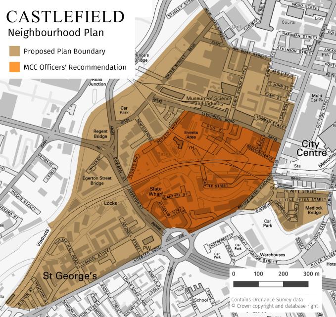 The differing views of residents and the city council officers
 One of the council's planning officers has written, in documents Confidential has obtained, that:
'Officers' initial assessment is that the most appropriate boundary for the Castlefield Neighbourhood Area would be less extensive, broadly bounded by: Deansgate/A56 to the south east; Liverpool Road to the north east; the River Medlock/Potato Wharf to the north west; the Mancunian Way to the south west.
'It is considered that these boundaries capture the area that most people would consider to be Castlefield in terms of physical character and activity, avoid areas covered by existing development frameworks and would be consistent with national policy guidance on Neighbourhood Area boundaries. This issue has been discussed previously with the Leader, and he has agreed that this approach seems sensible. We would, of course, welcome the views of local ward members on this issue.'
Clearly council planners are worried that future development might be held back by such a large Neighbourhood Planning area. As they have also said, the residents' map 'includes a number of areas covered by current Council development framework documents (such as St Johns), where the Council has already approved development policy.'
Unfortunately, the city council's own Strategic Plan 2015-18 from as recently as March 2016 puts much of the area the residents are claiming firmly into Castlefield.
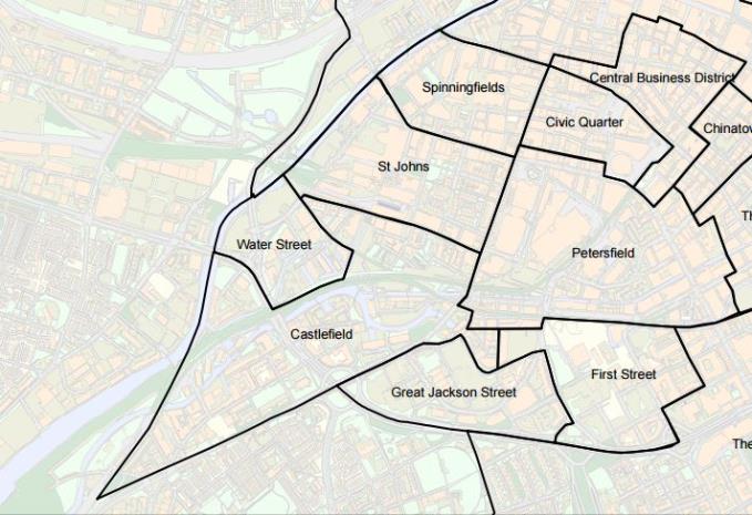 Oops, much of the residents' area corresponds to the council's existing maps
As for Confidential, while we think snaffling everything up to Quay Street is a bit cheeky of the residents, taking in the existing St John's residences south of the Gardens and then everything down to the river south of Liverpool Road seems to make sense. As does including the Knott Mill and Britannia Mill spurs. The tiny area suggested by the City Council in their recent report not only seems to fight against their own notion of what Castlefield is, but worse, appears too small to have real teeth.
The Neighbourhood Planning Consultation ends on 18 April. The results of the Consultation should go to the city's executive committee on 3rd June with an officer recommendation. For residents who want to get involved find more information here on www.ourcastlefield.co.uk
Powered by ![]()