


Need a nature fix? How to escape the city when you haven’t got a car
IF you’ve ever resorted to a trip to the local cemetery because you’re craving the sight of grass and trees, you likely know how it feels to be city-bound and without a car. And while Manchester has lots of fantastic parks (and burial places), there are days when you want to be somewhere wilder with bigger skies and wider views.
The wreckage is scattered across the isolated moorland on Bleaklow and makes for a very somber and eerie sight.
This desire to escape to the countryside is nothing new for us Mancs; it was a group of young Manchester mill workers who led the Kinder Mass Trespass in 1932 - an event which led to the creation of the National Parks.
With this intrepid past in mind, we’ve put together our top 10 walks you can do by train from Manchester Piccadilly and Manchester Victoria. They range from easy strolls to full-day hikes and all are beautiful at any time of year.
We’ve included a link to an online map for each one to give you the gist of the route but we highly recommend you take an Ordnance Survey map as well, preferably a paper one so you can still use it if your phone battery dies. We've listed which OS map you need under each walk. Also, don’t forget ample food and water, a plastic bag to take your litter home, suitable clothing and footwear, and suncream (here’s hoping).
Manchester is known as a flat city but look to the horizon and you'll see higher ground. Exploring these moorlands and hills is in our blood, so let’s roam.
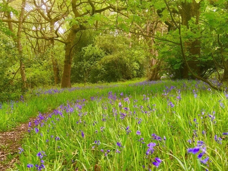
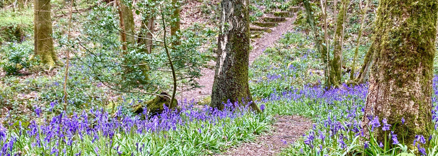
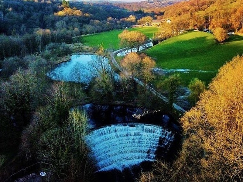
Bluebell woodland in Broadbottom
You’ve a range of options from this village on the edge of Tameside, depending on your commitment and energy levels. For a proper walk with hills and expansive views, go for the 12km Cown Edge loop. On a good day, you can see as far as Wales from the highest points.
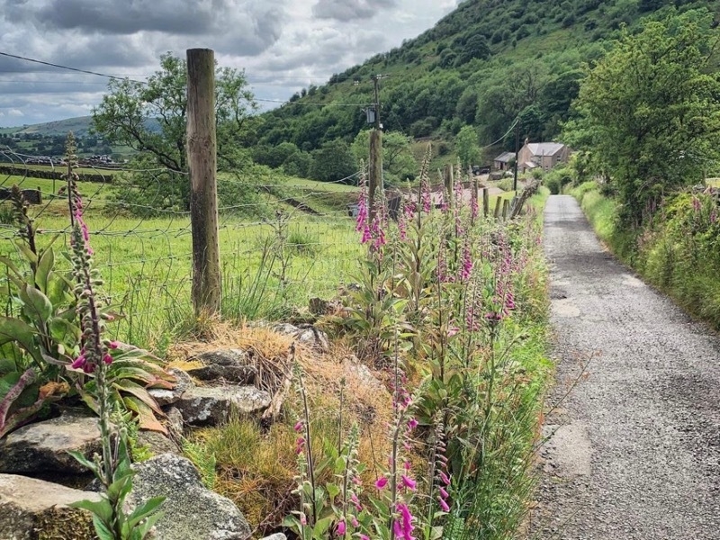
For a much shorter trail, head right when you get out of the station car park, go down the main road, over the bridge, and up the road or Pennine Bridleway for 150 metres to the Church of the Immaculate Conception. A public footpath from the graveyard leads to the Woodland Trust’s Tom Wood (main picture). Go in late April or early May and it will be full of bluebells.
Alternatively, head right from the station, down the main road, and follow the sign for Lymefield Garden Centre to explore the heritage site of Lymefield and Broadmills. These easy woodland paths wind through the remains of the mills that once stood here. Combine it with a visit to the farm shop and cafe at the garden centre.
Train: Manchester Piccadilly to Broadbottom
Journey time: 21 minutes
Cost: £6.30 off-peak
Route: see links in description
Distance: various options from 3km to 12km
OS Map: The Peak District - Dark Peak Area. OL1
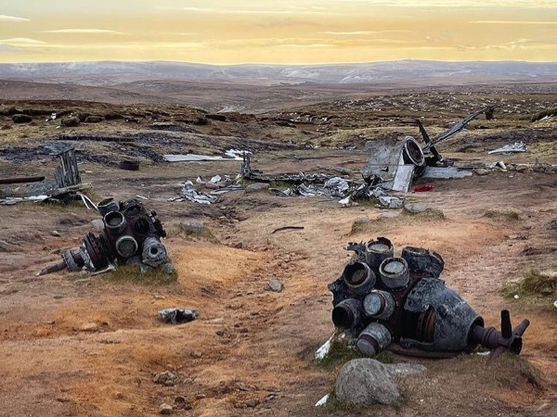
The Bleaklow Bomber
Walk up onto the moors above Glossop to see the crash site of "Over Exposed", a B-29 Superfortress, one of the largest aircraft in the skies during WW2. It collided with the hillside in low cloud in 1948, killing all 13 people on board. The wreckage is scattered across the isolated moorland near Higher Shelf Stones on Bleaklow and makes for a very sombre and eerie sight.
Bear in mind that this is a challenging walk. It’s long, steep and often boggy so you need to be confident of your fitness levels and well-equipped with the right clothing and provisions. You’ll need all day to complete it so get an early train and make sure you leave enough daylight to get back. It’s very easy to get lost up there so turn back if Bleaklow is in cloud, or if the cloud descends while you’re approaching it. (You can always come back on a clearer day; that plane’s not going anywhere.)
To get to the start of the route, turn left when you leave Glossop station and follow Norfolk Street, Hall Meadow Road, Church Street and Church Street South, to get to Shepley Street. It takes about 30 minutes to walk from the station to the start point.
Train: Manchester Piccadilly to Glossop
Journey time: 30 minutes
Cost: £7.10 off peak
Route: Walking Britain: Bleaklow Bomber
Distance: 18.5km
OS Map: The Peak District - Dark Peak Area. OL1
Roaming around the Etherow
With beech woodland, secluded lakes and steep pine forests, there’s a lot to like about this country park owned by Stockport Council. And the further you get from the car park and cafe, the quieter and prettier it gets. Once you’re there, you can wander, mapless, without danger of losing your way - the paths are all clearly marked and signposted. Go there for bird-watching, den-making, or just to stroll.
To get to the start of the route, turn left when you leave Marple station and walk down the hill to Brabyns Park. Go through the park to Rollins Lane, follow it to Compstall Road, then head down the hill to the Etherow Country Park. It takes about 25 minutes to walk from the station to the start of the route.
Train: Manchester Piccadilly to Marple
Journey time: 21 minutes
Cost: £6.30 off-peak
Route: All Trails: Etherow Country Park
Distance: 7km (less if you prefer)
OS Map: Not needed but it’s OL1 if you have one.
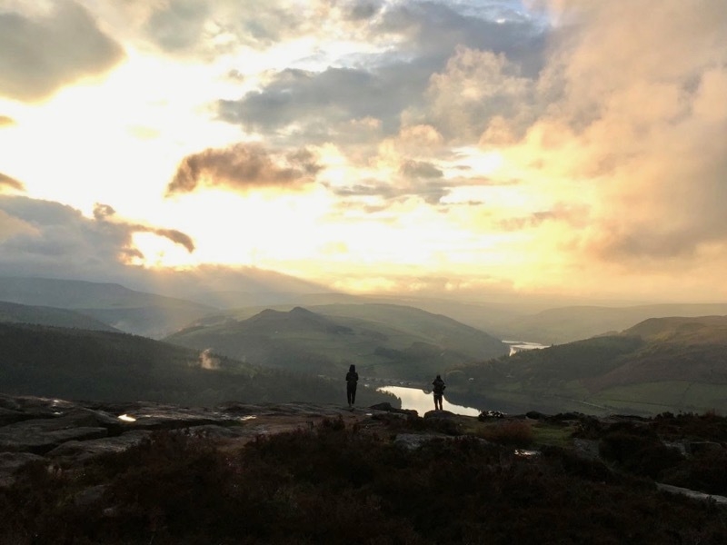
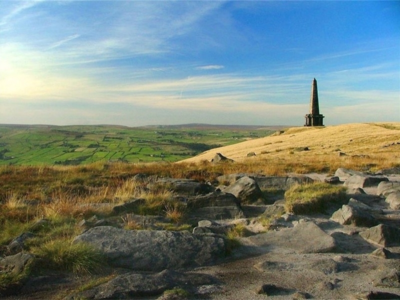
Big skies at Bamford Edge
Head to Bamford Edge for awe-inspiring views of the Dark Peak. This vantage point looks out over the Hope Valley and Ladybower Reservoir and is a stunning spot for watching the sunset. It gets busier than Blackpool on a sunny day, but you’re on the train so you don’t have to worry about finding a parking space. Go on a weekday, or in the evening, or in rain, to soak up the beauty without the crowds.
To get to the route, turn right from Bamford station and head up the main road into the village where you can pick up the trail at The Anglers Rest. The first stretch takes you up The Clough, one of the steepest roads in Britain. The views and photo ops at the top will make up for it, we promise. The edge itself is a much-loved location for the classic "standing on a rock" Instagram shot.
Train: Manchester Piccadilly to Bamford
Journey time: 53 minutes
Cost: £12.90 off peak
Route: Peak District Kids: Bamford Edge
Distance: 10km
OS Map: The Peak District - Dark Peak Area. OL1
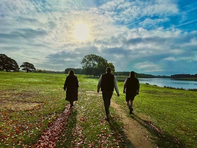
Tatton Park by train
With rolling parkland, mile-long driveways and free-roaming deer, Tatton Park has all the hallmarks of the English country estate. Including a location in the middle of nowhere that at first glance looks impossible to access by public transport.
But while the main entrance at Rostherne is best left to car drivers, you easily can walk into Tatton Park from Knutsford station. This route takes you from the centre of Knutsford, through Dog Wood and along Tatton Mere, past the Old Hall and round towards the mansion, playground and cafe, and back. There are lots of ways to shorten it if you find you just want to sunbathe, read, and live out your Bridgerton fantasies.
Train: Manchester Piccadilly to Knutsford
Journey time: 45 minutes
Cost: £8.70 off-peak
Route: All Trails: Tatton Park
Distance: 12.5km (or shorter if you prefer)
OS Map: Not needed but it’s OL1 if you have one.
Time out at Lyme Park
Another one for the costume drama fans, the brooding scenery of Lyme Park comes complete with a gothic hunting tower, windswept moorland and soul-stirring views of the Peak District. There’s also a cafe for coffee and cake, handily located about halfway along this route.
The car park here gets super busy in high season but you can avoid that by catching a train to Disley and walking in (saving yourself the entrance fee while you’re at it).
Train: Manchester Piccadilly to Disley
Journey time: 28 minutes
Cost: £7.50 off-peak
Route: Walking Britain: Lyme Park
Distance: 9.8km
OS Map: The Peak District - Dark Peak Area. OL1
A hike up Stoodley Pike
This one’s a linear walk from Hebden Bridge to Todmorden, via the imposing monument on the top of Stoodley Pike. It’s mainly hills and moorland and follows the Pennine Way in parts, with a stretch along the canal at the end.
There are plenty of places to refuel in Tod - have a look at our foodie guide to Calderdale for inspiration. You can take the train home from there or walk back along the canal to Hebden Bridge if you’re feeling energetic.
Train: Manchester Victoria to Hebden Bridge
Journey time: 27 to 37 minutes
Cost: £11.30 off-peak
Route: All Trails: Hebden Bridge to Todmorden
Distance: 10.5km
OS Map: South Pennines. OL21
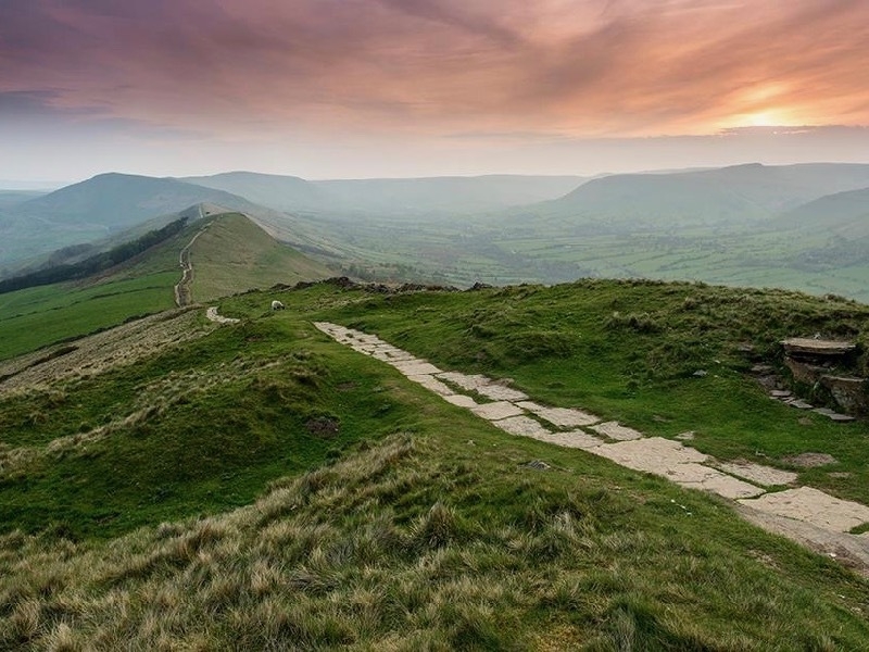
Edale to Hope via The Shivering Mountain
This famous ridge walk takes you from Edale up to Mam Tor, or the Shivering Mountain as it's been called thanks to its tendency to move about a bit. (You can see the collapsed road beneath it on the Castleton side).
From there it’s a well-trodden and well-marked route along the ridge to Lose Hill, then down into Hope. You can walk back to Edale via Castleton if you like, or catch the train in Hope for a shorter, though still substantial, hike.
Train: Manchester Piccadilly to Edale
Journey time: 43 minutes
Cost: £12.80 off-peak
Route: All Trails: Edale to Hope
Distance: 10km
OS Map: The Peak District - Dark Peak Area. OL1
Up Tegg’s Nose
Tegg’s Nose Country Park is just a mile outside Macclesfield, making it easy to get to by train. This route takes you from the station and up to the top of the Nose, where you can take in views of the Cheshire Plain and Macclesfield Forest before dropping down to the reservoir below.
There are six pubs on route so you’ll never be far from refreshments if the going gets tough.
Train: Manchester Piccadilly to Macclesfield
Journey time: 30 minutes
Cost: £8.80 off-peak
Route: Outdoor Active: Tegg's Nose from Macclesfield station
Distance: 11km
OS Map: The Peak District - White Peak Area. OL24
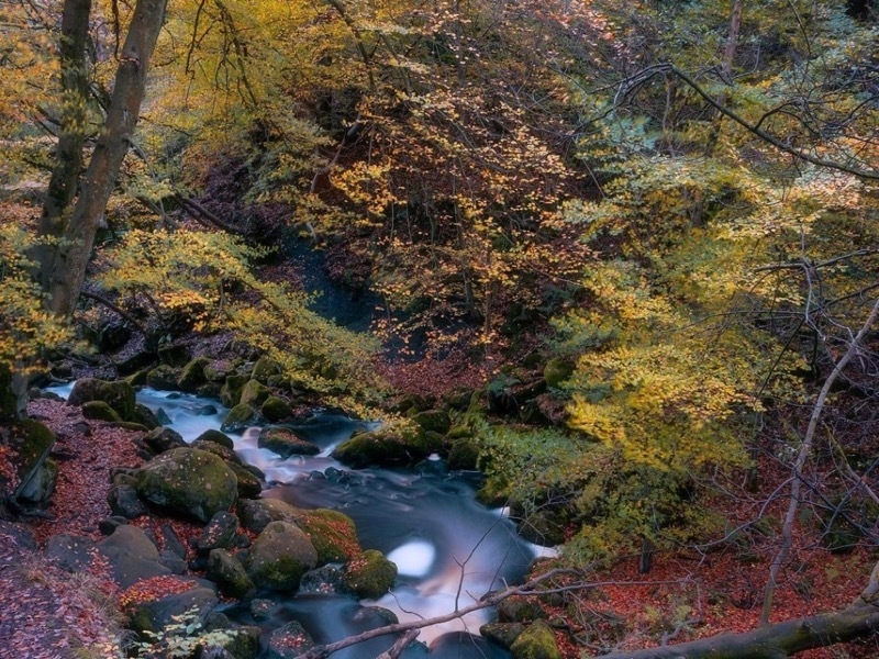
Padley Gorge and Surprise View
It’s further on the train but it’s worth it to visit this magical gorge with its tumbling waterfalls and ancient woodland. This route takes you up through the gorge and across the moorland to the vantage point of Surprise View and back again.
This area is popular with families in summer - there are paddling spots once you reach the river at the top of the gorge, and there are usually a couple of ice cream vans around too.
Train: Manchester Piccadilly to Grindleford
Journey time: 1h
Cost: £11 off-peak
Route: Let's Go Peak District: Padley Gorge
Distance: 7km
OS Map: The Peak District - White Peak Area. OL24
Follow @BodyConfidential on Instagram
Head to Confidential Guides for more ideas for walks near Manchester.
Read next: All who wander: Beautiful spots for a walk near Manchester
Read again: Top of the copse: Woodland walks near Manchester
Get the latest news to your inbox
Get the latest food & drink news and exclusive offers by email by signing up to our mailing list. This is one of the ways that Confidentials remains free to our readers and by signing up you help support our high quality, impartial and knowledgable writers. Thank you!