A NEW masterplan has been released for the 'Medieval Quarter' of Manchester (see page bottom) which introduces a comprehensive and seemingly sensible greening of the area. The Medieval Quarter is from Hanging Ditch to Victoria Station and bordered on the west by the River Irwell, although the landscaping will take in both sides of the river.
As with all these matters though, there must be money set aside to provide maintenance at a very high standard
This time it looks like a solution might be found at long last for the waterfront adjacent to Manchester Cathedral and Chetham's Library and Medieval Buildings.
This has been a long time coming. We've arrived here after a lot of ideas some of which removed the river, so to speak.
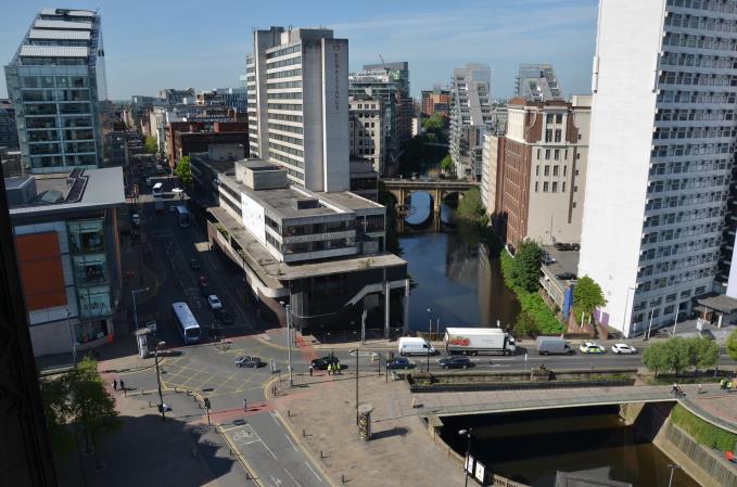 What to do with the river - looking south from the Cathedral tower
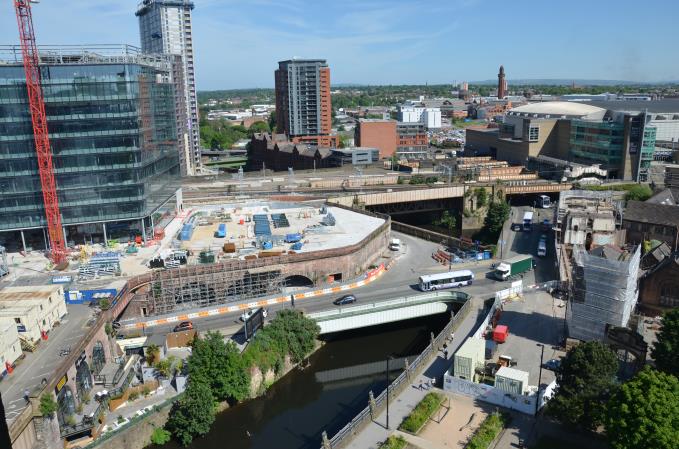 The river from the Cathedral Tower looking north
The long-defunct Daily Despatch printed an article in 1905 entitled Manchester as it might be: Hiding the Irwell. After a century of industrialisation the River Irwell had become a problem, a stinking mess of sluggish half-liquid, rank with industrial and human waste. The solution to this unsightly and smelly dilemma seemed simple, hide the river.
The Despatch wrote: ‘It has been proposed that the unsightly portion of the River Irwell which passes the centre of Manchester should be covered in to form a large square opposite the Cathedral and Exchange Station with a fine new thoroughfare running parallel with Deansgate through Blackfriars.’
The new street, perhaps to be called New Irwell Street (the suggestion of Effluent Street was purely satirical) was going to mark a move away from the strictly utilitarian nature of planning. It was to be lined with trees on both sides. It may also have been ‘permissible to allow cafes of the sort seen in Continental towns and cities with external service, if the English weather should allow’.
Revolutionary indeed. Manchester had to wait another ninety years for those outside tables and chairs.
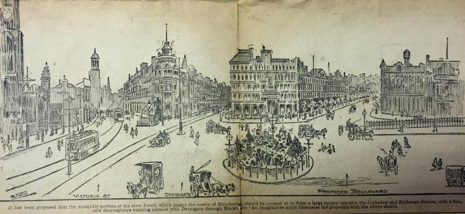 Hide the smelly thing, 1905 style
The plan to cover the river was revitalised with the 1945 Manchester Plan, which would have been even more ambitious in denying the city contact with its ancient watercourse. This would have covered the river from Victoria Station to a point between Bridge Street and Quay Street. A dual carriageway with lawns would have sat over the river on the southern part with a smaller road and landscaping next to the Cathedral and Chetham's. The result would have been green but dry, with the river hidden away.
None of this happened of course. The River Irwell remains visible and is rapidly cleaning itself. Brown trout are back in the river and occasionally herons and even kingfishers can be spotted in the city centre. Planners are now turning to face the river rather than putting their backs to it.
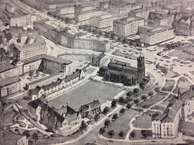 From the Manchester Plan 1945
 Making a feature of the river, rather than ignoring it, was one of the key criteria in the Masterplan for rebuilding the damaged city centre after the IRA bomb of 1996.
The time was right. With the decline of industry and with legislation designed to clean up the environment, nature, as we have seen, was once more asserting itself. Unfortunately standing in the way of the Masterplan was a large lump of concrete.
The aptly named Shambles development from 1972 by architects Cruikshank and Seward squatted on both sides of Deansgate and along the river bank. The Shambles development provided an introverted set of buildings, shunning not only the river but the streets they suffocated. They were an example of cold concrete Brutalism at its worst.
In the years immediately after the 1996 IRA bomb, Shambles East was demolished and New Cathedral Street and No 1 Deansgate arrived bringing shops and apartments. The surface car park behind the Corn Exchange was also landscaped to become Cathedral Gardens and Urbis was built. A new square, Exchange Square, was dropped between the old route of the A6 and Hanging Ditch.
Getting rid of Shambles West, between Deansgate and the river, has proved more difficult.
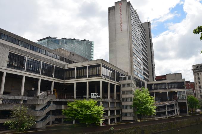 Big and brutal and concrete
Then, in 2007 and 2008, a scheme designed by Ian Simpson Architects and promoted by developers West Properties appeared to provide the solution.
Shambles West was to go, instead the River Irwell would reassert itself. There was to be public access on two levels along the river bank including a square hung over the river, together with 248 apartments, a 240 bedroom hotel, two commercial office blocks and ground floor retail and commercial space.’ It all looked splendid.
The proposals were supported and approved by Manchester City Council in June 2009. The Commission for Architecture and the Built Environment (CABE), wrote: “CABE admires the intelligence of this scheme and the skill with which the design team has responded to the brief and the challenges presented by the site...overall it is felt the benefits this scheme will bring to the city of Manchester will ensure it is regarded as a fitting final piece of redevelopment in line with the post-bombing masterplan for the city centre.”
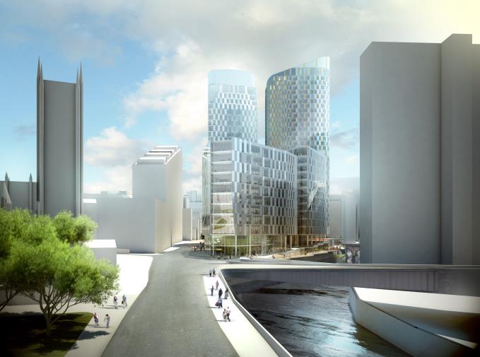 Enticing plans
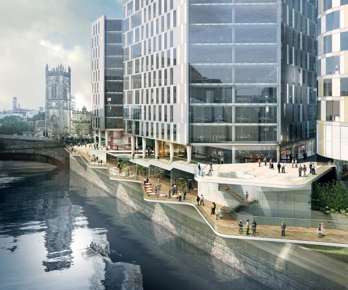 Talking to the river once more
The economic slump of the late-noughties laid the plans low and the developer, West Properties, went bust - went west you could say. New plans are being drawn up for Shambles West which will include public access to the river, rumour has it that these will start to be implemented by the end of the year.
Now we have the next plan, this is led by the public sector and lies a little to the north. This looks like it might actually happen since, as a start, £2m 'from the residue of funds from the Irwell River Park scheme' has been found, in an overall costing of almost £11m. The Council say they have 'identified six types of benefit from public realm investment (in this area) – attracting businesses, attracting visitors, improving productivity, increasing land/property values, increasing tourism and enhanced image.'
Medieval Quarter Plans:
On Wednesday 1 June the City Council agreed plans for a £10.8m overhaul of the city’s Medieval Quarter – home to Manchester Cathedral, the Corn Exchange and Chetham’s School of Music.
Advised by SimpsonHaugh and partners, the masterplan focusses on enhancing and beautifying the public realm in line with the significant investments and improvements made in the area, including the £44m revamp of Victoria Station, the £30m renovation of the Corn Exchange and the new Metrolink station in Exchange Square.
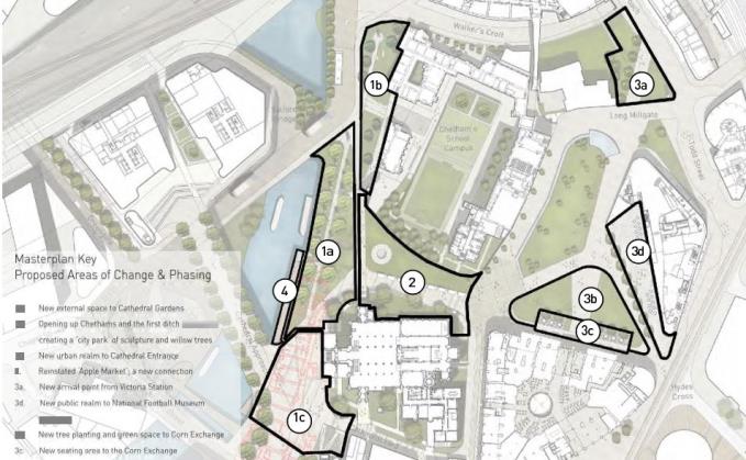
The masterplan contains five key elements in order to transform the Medieval Quarter from a ‘fragmented and incoherent area into one of the most impressive destinations in the city centre’. The plans include:
A new park on the River; uncovering the riverfront and reinstating the ‘Apple Market’; an integrated visitor experience for the Cathedral and Chetham’s; sheltered external seating for the Corn Exchange; £715,000 worth of public art; and the planting of new willow trees, amongst other improvements.
Meanwhile, as part of the plans to improve the public realm the council is currently in negotiations with Chetham’s to take a long lease of the site of the demolished Palatine Buildings.
The designs will now go out to public consultation.
All of these are pretty obvious, of course. The main enhancements will take place in landscaping with trees prominent along the closed section of Victoria Street with improvements along Fennel Street leading into more improvements in Cathedral Gardens. The small section of greenery in front of Victoria Station will also be upgraded. The bridge leading to Exchange Street will bear trees as will a landscaped area on Hunts Bank close to Chetham's Library and Medieval Buildings.
It's early days for these plans but given there is money actually in place it appears some of the dreams of earlier years may become reality before 2020. As with all these matters though, there must be money set aside to provide maintenance at a very high standard, one commensurate with the ambitions of a major British city. Attention to detail must be everything and placed at the forefront of any changes made in the area.
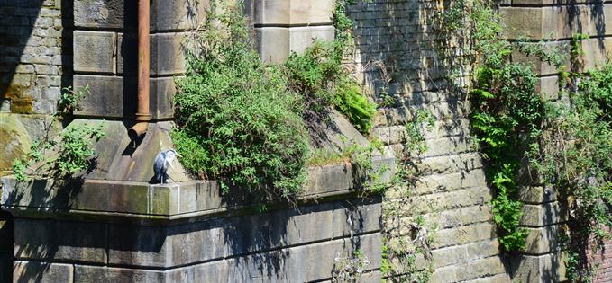 A heron on the river where Hunts Bank crosses under the Victoria Station rail viaducts, over the river from the planned landscaping
 Powered by Wakelet


